 RSS Feed


 July 22nd, 2017
  Awake Goy
 A new service by Google Earth and Google Maps, reveals the levels of land clearance in the planet’s largest rainforest responsible for producing 20 percent of the world’s oxygen.
The U.S.-based transnational unvelied the project “I am Amazon” in the Brazilian city of Sao Paulo.
It aims to combat the growing deforestation and to preserve the Indigenous cultures living in the forest.

“On Google Maps and Earth, you can now see the names of certified indigenous territories in Brazil, search for indigenous territories using the name of the ethnic group living there and see how forests are maintained in these areas compared to other parts of the Amazon,” Raleigh Seamster, Program Manager, Google Earth Outreach, said in a blog post.
Indigenous leader Almir Surui welcomed the initiative saying it will help “to show the environmental and forest-related issues of the Amazon.”
He explained that since 2007, Google has trained the about 1,500 Indigenous members of his Surui tribe to understand technology “with awareness,” teaching them how to map local issues and show aspects of their culture both domestically and abroad.
The project was supported by Brazil’s National Indigenous Foundation (FUNAI) and the Instituto Socioambiental, which helped to map historical and cultural aspects of the region, as well as its rich fauna and flora.
“By defining Brazil’s indigenous territories we can show the world the role these communities play in maintaining global socio-biodiversity,” FUNAI’s President Artur Nobre said in a statement.
The Institute’s president, André Villas Bôas, told EFE that the initiative could help to monitor the territories labeled as “vulnerable” and to protect them.
Google Earth offers 11 stories linked to various parts of the Amazon. Each video includes a description of the local food, Indigenous communities, social struggles and challenges for the environment.
Claudinete de Souza, leader of the Associations of Quilombo Associations, said that the project “put the light on the existence of regions and communities to which Brazilian public institutions have turned a blind eye”.Quilombos are hinterland settlements founded by Afrobrazilians who had escaped slavery.
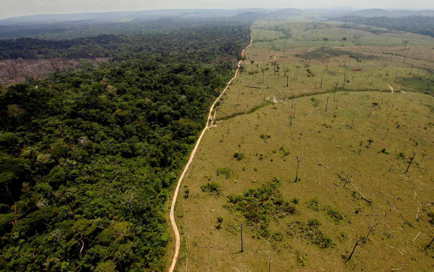
A deforested area near Novo Progresso in the northern Brazilian state of Para (AP Photo)
She mentioned as an example the historically first Quilombo, Boa Vista de Trombetas, located in the town of Oriximina, in the northern state of Para. “We are being oppressed, and forgotten. So the opportunity to show to the world that we are there is amazing,” said Souza.
A series of policy changes in recent months in Brazil have rolled back environmental protection amid political upheaval and an economic crisis engulfing President Michel Temer.
During the turmoil following the impeachment of his predecessor Dilma Rousseff, the “ruralista” lobby bloc in the National Congress of Brazil, which represents the interests of agribusinesses and large landholders, has been urging legislation to reverse the longstanding protection of the Amazon rainforest.
One of the measures introduced by lawmakers would remove environmental protection for 1.2 million hectares – an area larger than Jamaica.
Last Friday, Brazil’s government sent Congress a bill to open up 860,000 acres of a protected national forest in the Para area to logging, mining and agricultural usage.
Environmentalists say fewer restrictions will lead to open the doors to illegal-logging, land clearance and mining.
In 2016, deforestation of the Amazon rose by 29 percent on the previous year, the biggest rise since 2008, according to the government’s satellite monitoring reports.
This may impact Indigenous communities as deforestation rates in reserves under tribal control accounted for less than one-tenth of the losses seen in other forest areas, according to a study published last year.
A more recent report by the Pastoral Land Commission (CPT), a Brazilian advocacy group, says the country is one of the world’s most dangerous for land rights activists, with 61 killings last year, the highest level since 2003.
© teleSUR
Source Article from http://www.mintpressnews.com/indigenous-tribes-brazil-map-deforestation-google-earth/230014/
 Posted in
  Tags:
Tags: 


