 RSS Feed


 December 10th, 2020
  Awake Goy
 Helicopter Lidar scans have revealed an ancient Amazonian “cosmos” of circular settlements, all connected by straight roads.
Acre is an Amazonian rainforest state in northwestern Brazil known for Brazil nut trees and the production of rubber. In the west, on the Peruvian border, the Serra do Divisor National Park features high mountains and several waterfalls, and in the southeast is Rio Branco, the state’s capital, on the banks of the Acre River.
Lidar scanning specialists from England’s University of Exeter have flown high resolution sensing equipment over the canopy of the rainforest in south Acre State. Not only did they identify 35 circular villages dating to 1300–1700 AD, but all of the settlements are linked by a network of old straight tracks.
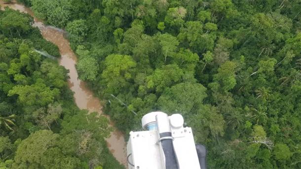
Lidar scanning the Brazilian rainforest. ( University of Exeter )
Identifying the Lost Amazonian Cosmos
The full findings of the lidar study were published in the Journal of Computer Applications in Archaeology and it says Amazonians created these settlements around 700 years ago. Industrial deforestation and previous archaeological digs in Acre State revealed the presence of large earthworks and circular mound villages, but helicopter mounted scanning equipment has not been deployed before now. However, now that it has, the new study details how the villages all center around a series mounds with radiating roads connecting them.
The new findings indicate that ancient Amazonian people maintained “highly-defined social and architectural models for how they organized their communities,” according to the paper. Furthermore, the overall circular pattern “may have been a reflection of how ancient Americans perceived space as circular, with stellar constellations moving around the Earth.” Put another way, author and archaeologist Jose Iriarte of the University of Exeter , wrote “it may have represented the cosmos .”

Geoglyph Annex enclosures. a. Dois Circulos. b. Jaco Sa. c. Chiquinho. ( University of Exeter; Iriarte, J, et al. 2020 )
Charting the Ancient Network
Each of the settlements in the Amazonian cosmos has a center mound, the diameters of which ranged from 40–153 meters (131–502 ft.), and they are all enclosed by central plazas of around 0.12–1.8 hectares (0.3–4.4 acres) in size. Each village mound is connected by straight, sunken roads with high banks, that all radiate out from the center mounds of the villages. Also, most villages have a pair of deeper and broader principal roads aligned in northward and southward directions.

Examples of Circular Mound Villages in the Amazonian ‘cosmos’ of settlements, highlighting Principal Roads and Plaza area. a. Sol de Camila. b. Sol de Iquiri. ( University of Exeter; Iriarte, J, et al. 2020 )
Each settlement is connected across the wider landscape by further straight roads that also radiate out from the center of the villages. Furthermore, the complexity of this design matrix is multiplied ten-fold when we consider that some small groups of villages “exhibit regular distances.” So not only do their locations and alignments reflect cosmic principals, but they also adhere to carefully calculated measurements on the landscape, of “2.5–3 km [1.6–1.9 miles] and 5–6 km [3.1–3.7 miles] between sites,” according to the paper.
Putting this Cosmos in Context
Having now published their initial study, the researchers hope to unveil even more villages hidden beneath the veil of the rainforest, which according to the team were created by a culture that emerged sometime after 950 AD, “when a large geometrically patterned ceremonial earthwork was abandoned.” Out of context this discovery might seem unique, but from a continental perspective it’s really “just another” example of an engineered landscape designed to reflect cosmic principals. For while these Amazonians were laying out their cosmos of mounds and straight roads, so too were the Inca rulers in Peru, who built 41 straight “ siq’i” (ceque lines) emanating from the Coricancha Temple of the Sun at the center of their capital city, Cuzco.
These lines organized the surrounding “ huacas” (shrines and sanctuaries) and constituted a complex and deeply religious spatial system that radiated over the entire Inca Empire, connecting the major and minor settlements and holy places. The lines united geography, geometry, and astronomy with the social environment and each of the 328 huacas (one for every day of the lunar year ) represented a heavenly body, black nebulae, star or planet, and each sacred site also identified a different social group.
It is much too early for the archaeologists in Brazil to even suggest that the ancient managed landscape includes any of the attributes given to the ceque lines of Peru , but with so many roads aligned with the four cardinal points of the compass the researchers must be full of anticipation as to what this network might have represented, as much as how it might have functioned socially.
Top image: Outlines of two villages in the Amazonian cosmos of rainforest villages in Brazil. Source: University of Exeter
By Ashley Cowie
 Posted in
  Tags:
Tags: 


