 RSS Feed


 June 27th, 2023
  Awake Goy
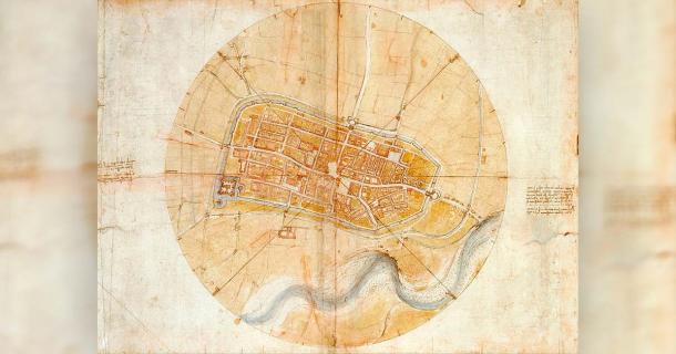
In 1502, while working as a military engineer for Cesare Borgia, Leonardo da Vinci undertook the task of creating a unique map of Imola.
Section:
Related posts:
15yo Indian girl gang-raped, hanged from tree ‘to make it look like suicide’
'Gang of Immigrants' Assault, Curse Out School Boys in Finland in Degradation Video
Religious zealots ready for takeover of Israeli army
LA Police Chief Recommends Criminal Charges for Killer Cop
This insane Joe Biden video proves the Democrats are determined to lose the POTUS election.
Landmark boycott victory as G4S says it is leaving Israel
 Posted in
  Tags:
Tags: 


