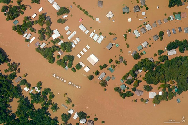
Above photo: Flooding devastated area in Port Vincent, Louisiana along the Amite River southeast of Baton Rouge. NOAA Remote Sensing Division.
About 2,000 official and potential Superfund sites—sites contaminated by extremely hazardous chemicals—are located within 25 miles of the East or Gulf Coast. As sea levels rise, many of these toxic sites are at risk of flooding.
Millions of people live near these sites, and flooding could bring them into contact with hazardous chemicals. The areas near Superfund sites are disproportionately populated by communities of color and low-income communities.
Yet the Trump administration in 2017 rescinded an executive order requiring consideration of flooding at these sites and canceled research into the problem.
If leaders continue to sideline science when making decisions about climate change and about Superfund sites, they will put the health of millions of the country’s most vulnerable people at risk. In the report, we recommend steps that decisionmakers could take to ensure the resiliency of Superfund sites to extreme floods.
Downloads
Related posts:
Views: 0
 RSS Feed


 July 29th, 2020
  Awake Goy
  Posted in
  Tags:
Tags: 


